|
2011-02-26 tl;dr: After cycling all morning along the California coast I decided to peddle up a mountain. I failed. At no point today was I far removed from other people. Much of the California coast is laced with bicycle trails, and those trails are heavily used. As are the roads they often parallel.If you add up every bicycle I saw in every one of my previous trips I doubt if it would reach a number half as large as the number of bicycles I saw today. As expected, most of the bicycles I encountered were racing models with riders in full bicycle-weenie garb. As with every sport I expect many participants to submerge themselves fully into the culture. But cycling thwarts my understanding. Ninety-nine percent of cyclists I meet outside of a direct urban environment are dressed like candy wrappers. Is this some rule? I think I was more bugged by the fact that all of these cyclists with all of their light bikes and friction-free clothing were going down-wind. Certainly, I was passed a few times (as I go very slowly), but nowhere near as often as I statistically should have been. Lazy bicycle weenie hipsters. End rant. I also came across a few homeless folks. They were drying their gear. My route brought me from Oxnard through many coastal towns into Santa Barbara. With a head-wind every mile of the way. In Santa Barbara I stopped for a few minutes near the beach to admire the tourists. Though it never rained (for once) and was actually sunny it was still kind of cold and windy. It was amazing how many people were out and about. And then I turned inland and was more amazed. I followed State street for a couple of miles through tourists and fancy shops and stop lights. My goal was to head out of Santa Barbara into Rattlesnake Canyon Park on Gibraltar Road which would take me onto a loop that would point toward Solvang come morning. I am so silly. Gibraltar Road starts off going pretty much straight up. After a while it gets steeper. I thumped along for several hours in granny gears pushing up and around loops and being periodically passed by cyclists with substantially less weight than myself. One guy was especially pleased with my endeavor, yelling "You're the man! Yeah!" as he passed me going up-hill. Later, on his return, all I heard was "Yeah! Yeah! Yeah! Yeah!" as he zoomed by at forty miles an hour. Around 1800 feet I took a break and calculated that even as tired as I was I could reach the summit before dark; giving me enough time to quickly scoot down the other side to find a warm place to camp. Around 2200 feet I found myself taking more frequent breaks. Around 2400 feet I was putting on all of my layers to battle against the cold and had used half of my water. By 2600 feet I was pushing my bicycle. By 2800 feet, even that was hard. Round about 3000 feet it started to snow. Actually it was more like hail. It was too cold to be a wet snow, so I was pelted by frozen pea-sized balls of ice. That's when I gave up. I knew I was not tough enough to get to the top. I had another 900 feet at least, and even after that it wasn't all down-hill. Having lost my will and my gloves (a few days earlier), I wrapped my hands in socks still wet from yesterday and turned around. It took me hours to get up this mountain. It took minutes to get back down. Very very cold minutes. When I dropped to above-freezing, I sat on a rock and shivered until I built up enough heat to go on again. I had planned to camp, but that was before I back-tracked to Santa Barbara. Here's an obvious piece of knowledge: Hotels in Santa Barbara are expensive on the weekend. Still, I was exhausted and frozen, so I paid the price. I had no idea how much energy I had exerted trying to climb that mountain until I wandered across the street to the market. As I was shopping for food I suddenly found myself weak, had a hard time focusing, and almost felt like I wanted to pass out. Suddenly that expensive hotel room didn't seem so bad. Maybe after a couple more months of tackling these mountains I will be able to do better. |
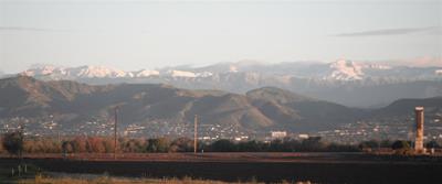 near Oxnard CA 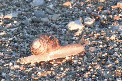 big Californian snail 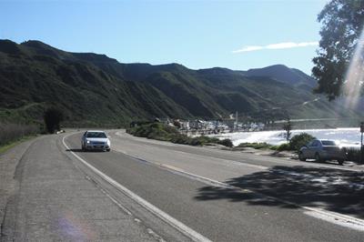 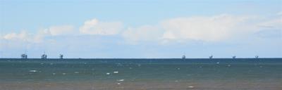 oil platforms 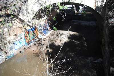 Toro Canyon Creek 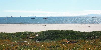 Santa Barbara beach 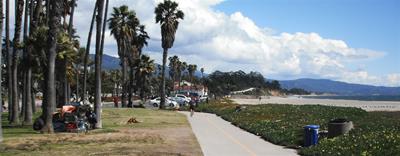 homeless people have more stuff than me 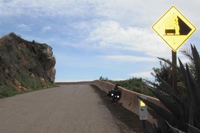 no kidding? 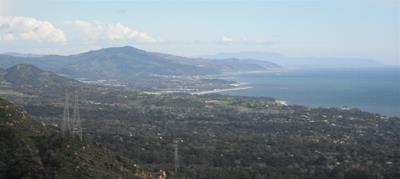 view from Gibralter Road 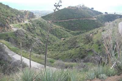 Gibralter Road -- I started off at that pier in upper-right corner 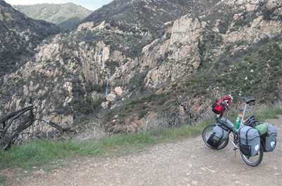 waterfall 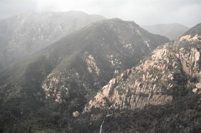 snow |